UK weather: Coldest night recorded since 2010 – and temperatures could go lower tonight
It was the coldest night in the UK for more than 10 years after -16.7C was recorded in the Scottish Highlands – and it could get even colder tonight, as snow and ice continue to cause disruption in some regions.
The temperature at Altnaharra plummeted to the lowest in the whole country since December 2010, according to the Met Office.
And the mercury could plunge further on Wednesday night into Thursday, with conditions set to get milder across the UK towards the weekend.
The cold snap has been dubbed the Beast From The East: The Sequel in a nod to a similar cold spell in 2018.
Transport Scotland has warned of long delays as well as cancellations to bus and rail services.
Meanwhile police in Norfolk warned of blizzard-like conditions and said many roads had fallen victim to snowdrifts and blockages.
More than 380 schools in the county were closed to all children, including vulnerable youngsters and those of key workers, on Tuesday due to the severe weather following Storm Darcy.

Vaccination centres in Ipswich and Bury St Edmunds in Suffolk and Clacton on Sea and Colchester in Essex remained shut on Tuesday amid the adverse weather conditions.
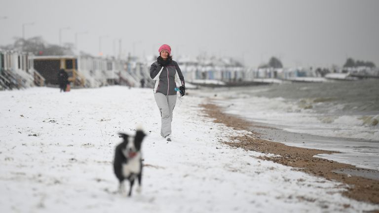
There have been reports that 10cm-15cm of snow fell in southeast coastal areas at the start of the week.
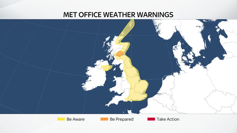
Sky’s weather presenter Isobel Lang said: “The Met Office has amber warnings for disruptive snow over central Scotland today, while there are widespread yellow warnings for snow and ice currently lasting through Wednesday.
“Snow showers will continue today. They will be mostly in the east, frequent and heavy over central Scotland, but there will be a scattering in the west as well.
“It will be cold again, with a raw wind in the south bringing a significant wind chill.”
She added: “Tonight there will be another widespread severe frost, with temperatures falling to -10C to -15C across the north.
“Expect further snow showers especially across southeast Scotland and the northern Pennines.
“Wednesday will be drier overall, but there will be further snow showers for eastern England in particular. There’ll be plenty of sunshine across western and northwestern areas.
“It will be cold, after a frosty start, but not quite as bitter or as windy as recently.”
Met Office spokesperson Nicola Maxey said: “There’s still a risk of snow anywhere down the eastern side of the UK.
“We’re in these cold easterly winds.
“The cold air crosses from Russia and eastern Europe, crosses the sea, picks up some moisture then when it hits the land you see rain or because the air’s so cold you see snow.”
Some snow is likely to continue through Tuesday and Wednesday but “more showery rather than large accumulations”, she said.
Ms Maxey said the UK had a “glancing blow from the northern edge” of Storm Darcy, which crossed northern Europe and was named by the Dutch weather service.
Temperatures will widely be below freezing overnight across the country and in low single figures in the daytime on Tuesday and Wednesday, she said.
Source: Read Full Article