Home » World News »
Temperatures set to drop as much as 40 degrees on East Coast
The East Coast is in for a rude awakening as temperatures drop as much as 40 degrees in some areas after a beautiful spring day on Saturday.
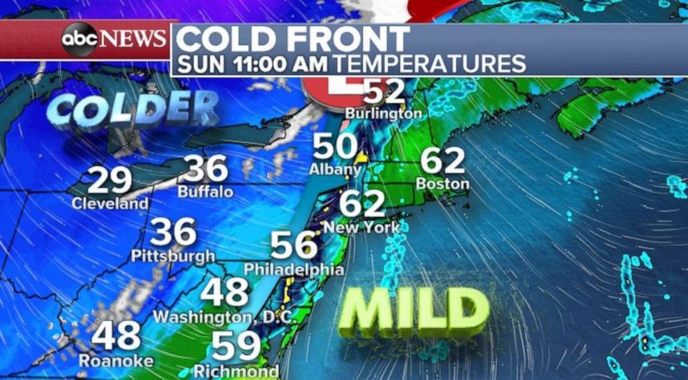
A strong cold front is moving across the eastern U.S. on Sunday morning. Showers and a couple of thunderstorms are forming along the cold front — extending from New York all the way down to Mississippi and Alabama. Temperatures are very mild on the warm side of the front, but those colder temperatures await.
Much of the East Coast, including Washington, D.C., Philadelphia and New York City, reached the 70s on Saturday, which combined with the sunshine to create the nicest day in months. The warm weather made it all the way to Burlington, Vermont, where the temperature reached 60 degrees — its warmest day since October.
However, it’s a much different story on the colder side of the front. Temperatures have dropped nearly 30 to 40 degrees. Cleveland reached a high of 60 degrees on Saturday, but are near freezing, with snow showers in the area, on Sunday morning. Nashville, Tennessee, hit a high of 74 degrees Saturday and it is in the 30s to start Sunday.
This classic spring cold front will move through the eastern U.S. and bring rain showers to the Interstate 95 cities later Sunday morning. Initially, temperatures may quickly jump into the 50s and 60s from Philadelphia to Boston, however, once the wind changes temperatures will drop significantly.
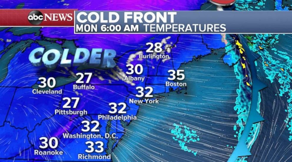
By Monday morning, temperatures will be near or below freezing in the Northeast — more than a 40-degree temperature drop over 24 to 36 hours. People will be going from short sleeves and shorts on Saturday to winter Jackets on Monday morning.
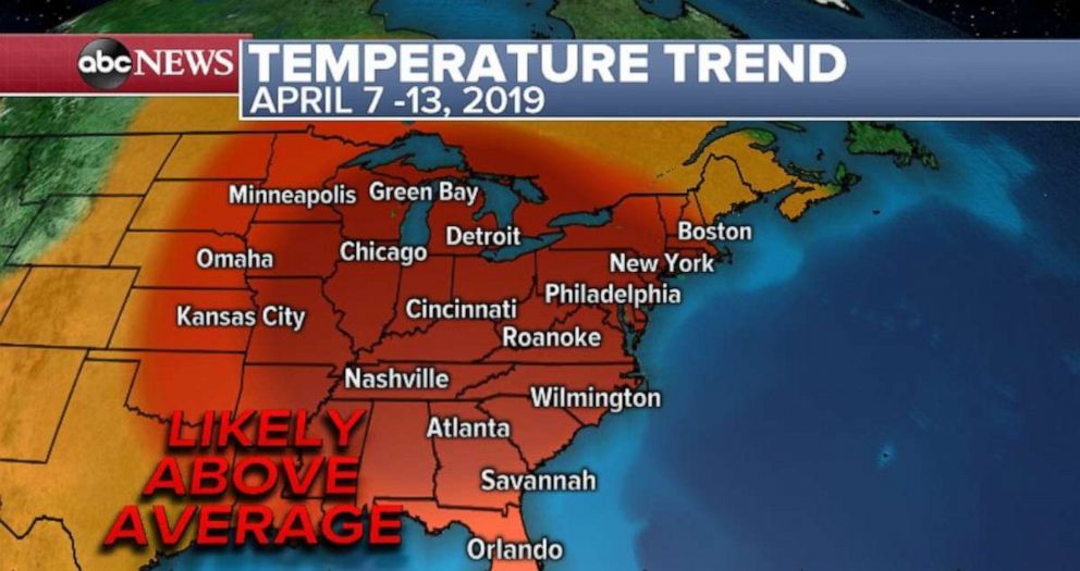
There is some good news for spring lovers, though. After this initial cold blast, mild air looks likely to dominate from nearly coast to coast for the first half of April. By the second week of April there are strong signals for above-average temperatures, especially across the Northeast and Mid-Atlantic.
This pattern could also be conducive to volatile weather in the central U.S.
New potent storm forms in West
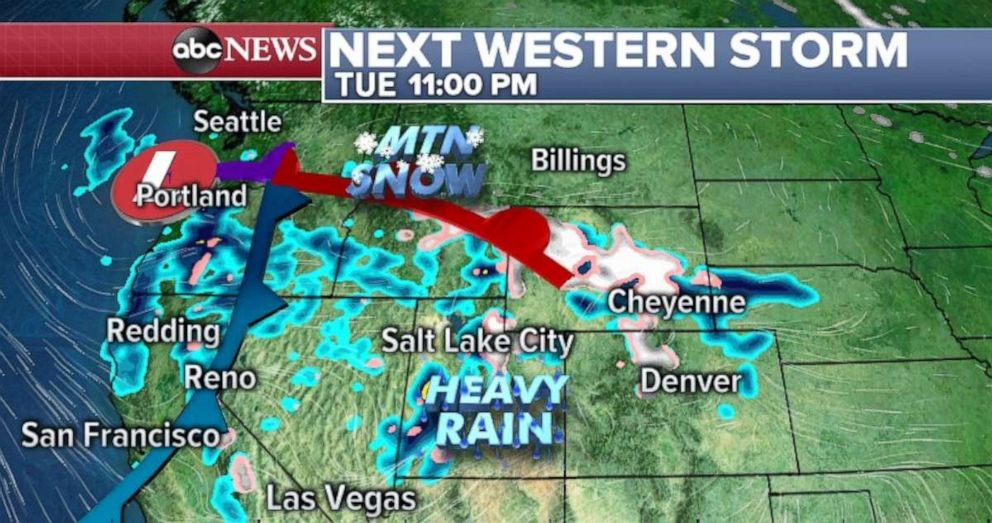
A new storm will arrive on the West Coast on Monday morning with its main effects spreading inland on Tuesday.
For the most part, this storm will be too warm to bring too much mountain snow initially, but some parts of the Northern Rockies could see some new spring mountain snow early this upcoming week. The coast of Oregon and Northern California could see 1 to 2 inches of rainfall form this system.
A couple of things will play out over the course of the upcoming week.
Simultaneously, a storm will develop along the southeast coast line Monday and Tuesday. Some fringe effects of the storm are possible, including rough waters and some rain from Florida to North Carolina, however, the storm gets pushed out to sea and exits without much impact to the southeast coast, and nearly no impact to Northeast.
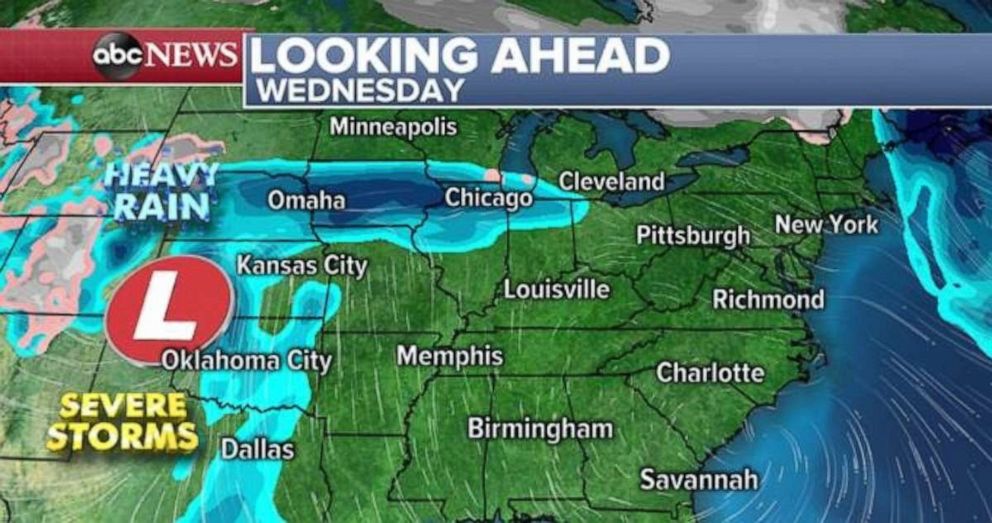
Some of the unsettled weather moving into the West Coast on Monday will give way to a new organizing storm in the central U.S. by Wednesday. This will bring the next round of severe weather to parts of the South, including Oklahoma and northern Texas and then into the Deep South, near Mississippi, Arkansas, Louisiana, by Thursday. The storm will also bring some more rain to parts of the Midwest, and could complicate ongoing river flooding.
All of this a sign that warmer air from the tropics is beginning to win out against the colder air from the Arctic as we head deeper into spring and the volatile months of April, May and June.
Source: Read Full Article
