Home » World News »
Coastal flooding hits East Coast this weekend as fire danger returns to California
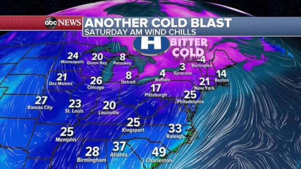
Yet another November cold blast is hitting the Northeast and Great Lakes this morning, with wind chills in parts of the Northeast in the 20s, teens and single digits.
Interested in Weather?
It feels like the 20s in New York and Philadelphia, and teens in parts of Boston. Wind chills in the single digits stretch back toward Buffalo and Syracuse and into Detroit.
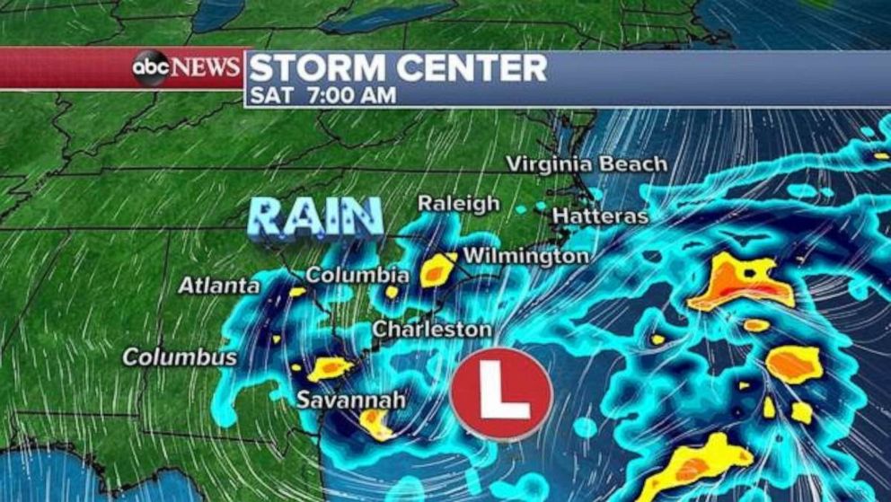
Attention turns to a developing coastal storm off the southeast coast of the U.S. This storm is bringing some heavy rain and gusty winds over 30 mph to parts of Georgia and the Carolinas this morning through Sunday.
The storm will gradually become more organized over the course of this weekend as it moves northward, moving parallel to the East Coast.
Meanwhile, a separate system in the upper Midwest will bring a little light snow to parts of the region, with only minimal accumulations expected. As this system races off to the East Coast it will begin to interact with this developing coastal storm and should help nudge it just far enough east to prevent widespread major impacts.
However, the result of a nearby strengthening coastal storm is rainfall and coastal flooding. Rain could be locally heavy and result in some flooding, especially closer to the coast on Sunday and Monday in parts of the Northeast. As some of that cold air moves toward the region, some precipitation may begin to mix in parts of the interior Northeast on Monday.
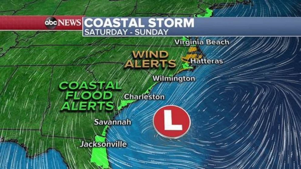
The more predominant and most serious impact from this storm will be the chance for coastal flooding along the East Coast. There are coastal flood alerts already in place from Florida to New Jersey.
As the storm strengthens and moves northward toward a high pressure system, the pressure gradient will strengthen the wind speeds and likely have an onshore component. That, combined with increasing winds and rough surf, will likely cause coastal flooding — in some cases significant. Areas along the immediate coast are likely to see periods of inundation, which could damage structures and be dangerous, especially during high tide cycles.
Additionally, some coastal areas — especially in the Carolinas and Mid Atlantic — could see winds gust over 40 mph this weekend and early Monday as the storm moves east of the region.
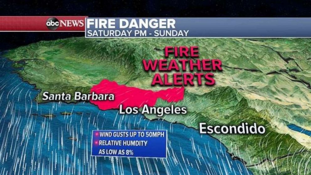
In the meantime, critical fire danger returns to Southern California this weekend with extreme fire behavior possible.
A high pressure system will move from the Pacific Northwest toward the Rockies, and this will drive dry winds over the Southern California mountains once again.
These dry Santa Ana winds will pick up on Saturday afternoon and evening and last through Sunday, with gusts locally up to 50 mph and relative humidity as low as 8%.
Therefore, this is critical fire weather and fire that develops could rapidly spread. Extreme fire behavior could be possible.
Source: Read Full Article


