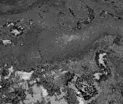
Tropical Storm Mawar Expected to Strengthen as It Moves Toward Guam
Tropical Storm Mawar rapidly strengthened in the Pacific and was expected to become a powerful typhoon, threatening to bring high winds and possible flooding to the Mariana Islands, including Guam, the National Weather Service said.
The storm, which formed early on Sunday morning local time and was slowly moving northward, could hit Guam, a U.S. territory, as early as Tuesday, said Brandon Bukunt, a meteorologist with the Weather Service.
“We might have to put out typhoon warnings, in which typhoon conditions are expected,” Mr. Bukunt said. “But for right now, given the uncertainty, we have a typhoon watch, which means that typhoon conditions are possible within two days.”
Tropical Storm Mawar had maximum sustained wind speeds of 50 miles per hour as of Sunday morning local time, when it was about 570 miles southeast of Guam, the Weather Service said.
For the storm to be classified as a typhoon, its wind speeds would have to be greater than 74 m.p.h., which they are expected to reach, Mr. Bukunt said.
As the storm approaches the islands, its winds are “going to pick up,” he said, and outer rain bands could bring heavy downpours, increasing the chances of flooding, including in Guam, which is home to Andersen Air Force Base.
Gov. Lou Leon Guerrero of Guam and Rear Adm. Benjamin Nicholson placed the island and its military bases on alert on Saturday for possible destructive winds, according to a statement from the base.
The base added that “all military installations on Guam are currently securing facilities and housing residents are urged to commence heavy-weather preparedness efforts.”
Typhoons can form year-round but are most common from May to October.
Tropical Storm Mawar, a Malaysian name that means rose, is the second named storm in the West Pacific this season. The first, Tropical Storm Sanvu, quickly weakened in less than two days.
Source: Read Full Article


