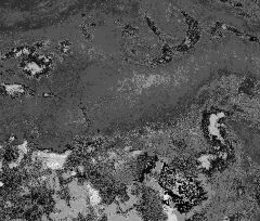
Hurricane Sally intensifies, could wallop US coast with 177kph winds
BAY ST LOUIS, Missouri/HOUSTON, Texas (REUTERS) – Hurricane Sally rapidly strengthened on Monday (Sept 14) over the Gulf of Mexico, the US National Hurricane Centre said, and could hit the central Gulf Coast on Tuesday as nearly a major hurricane.
The second strong storm in less than a month to threaten the region, Sally’s winds increased to 155kph.
It could wallop the Mississippi and Alabama coasts on Tuesday with devastating winds of up to 177kph, on the cusp of becoming a Category 3 hurricane on the five-step Saffir-Simpson scale of intensity, the NHC said.
Hurricanes are considered to have the potential for devastating damage when they have sustained winds past 179 kph.
Mississippi and Louisiana called for evacuations of low-lying areas and President Donald Trump issued an emergency disaster declaration for both states.
Alabama closed the state’s beaches and recommended evacuations of residents in low-lying areas.
“We are going to bear the brunt of this storm,” Mississippi Governor Tate Reeves told residents on Monday, warning that rainfall forecasts along the coast could exceed 50.8cm.
Ports, schools and businesses were closing along the coast.
“We have to make sure that everything is tied down and out of the way so it doesn’t float away or become airborne,” said Steve Forstall, a Bay St Louis, Mississippi, port employee.
Water from the bay spilled onto a beachside roadway in the coastal town, roughly 80km northeast of New Orleans.
Workers were boarding up homes and securing items that could become projectiles in high winds as residents filled sandbags, and moved cars and boats to higher ground.
The US Coast Guard restricted travel on the lower Mississippi River in New Orleans to the Gulf, and closed the ports of Pascagoula and Gulfport, Mississippi, and Mobile, Alabama.
Energy companies buttoned up or halted oil refineries and pulled workers from offshore oil and gas production platforms.
At 4pm CDT (5am Singapore time), Sally was 170km east of the mouth of the Mississippi River, packing sustained winds of 155 kph, according to the NHC.
‘RAINMAKER’
Sally “could approach major hurricane strength” overnight, the NHC said, adding it could not pinpoint landfall because of the storm’s slow movement.
It is expected to dump between 20-40cm on the coast, with isolated 60cm amounts, and cause widespread river flooding.
Mississippi appears more likely for landfall, but Sally’s biggest threat is that it will be a “rainmaker” across a wide swath of the Gulf Coast, with 7-10cm in areas as far inland as Atlanta, said Jim Foerster, chief meteorologist at DTN, an energy, agriculture and weather data provider.
Residents of southwestern Louisiana are still clearing debris and tens of thousands of homes are without power after Hurricane Laura left a trail of destruction.
Sally’s path remains east of that hard-hit area.
The US Federal Emergency Management Agency sent new resources without taking help away from southwestern Louisiana, Governor John Bel Edwards said on Monday.
There are more than 12,000 Laura evacuees staying in hotels in New Orleans, and Edwards advised them to “stay put in your shelter.”
Damage from Sally is expected to reach US$2 billion to US$3 billion (S$2.7 billion-S$4.1 billion), but could exceed that if the storm’s heaviest rainfall happens over land instead of in the Gulf, said Chuck Watson of Enki Research, which models and tracks tropical storms.
Sally is the 18th named storm in the Atlantic this year and will be the eighth of tropical storm or hurricane strength to hit the United States – something “very rare if not a record,” said Dan Kottlowski, senior meteorologist at AccuWeather, noting that accurate data on historic tropical storms can be elusive.
Source: Read Full Article


